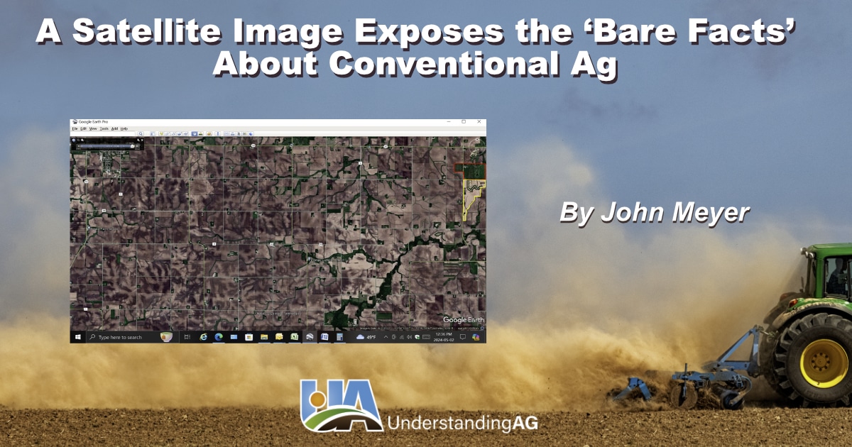
I pulled this image up on GoogleEarth yesterday. The photo below shows an area 12.5 miles wide, by 6.5 miles vertically, much of it in Rock Dell Township, Minnesota where our farm is. Hayfield is in the upper left-hand corner. The green area in the middle is along Hwy 30, and at the top is the Oslo subdivision.
This satellite image reveals that nearly every foot of this area has been tilled and "turned black," which is typical of "ag country." The image was taken on June 2, 2022, right after planting, but before the typical row crops were growing. Did you notice that farm in the upper right-hand corner, with the red perimeter boundary? Can you see how different, and "out of place" it seems to be on this image? It most certainly is an outlier. Notice how green it is? That's our farm, the "home place," one of four properties where we operate on. There's 270 acres inside that red boundary (so consider that when determining perspective and the percentage of area-wide coverage comparatively. The green area bounded by the red line is less than half a section, and the full image comprises about 81 sections for a total of 52,000 acres. So, our farm represents only about one-half of 1% of the land in the image.
Now notice the farm directly to the south of ours. That's my neighbor's farm who also happens to be a good friend of mine. The area bounded by yellow is where he had planted a winter rye cover crop following a canning crop. It's yellow in the image (instead of brown like the rest of the land), because he had chemically terminated that winter rye about two weeks before the picture was taken, when the rye was about 4-feet tall. He had already no-till planted his soybeans directly into that winter rye crop while it was still standing, right after the chemical termination application pass. He does this as a function of his regular farming practices all the time now, as well as "no-tilling" or "minimum tilling" most of his land, and he's doing a great job. That same area right now has rye about 24 inches tall on it... and of course, it's currently "green as grass." THAT area is about the same size as my farm on the image... so between the two of us, our "cover cropped land area" is about 1% of the total land area represented in this image.
Now, did you notice how the rest of the image is all "dirt colored?" The only green is in those "left undisturbed wasteland areas" along a creek or river., (You can see how any water that "sheds" off of the land goes directly into these surface waters). Nearly every other acre in the rest of the landscape is tilled "black" (or brown in this case), almost EVERY fall, and EVERY spring. EVERY square inch of all those "brown areas" have been treated with various chemicals and fertilizers.
The herbicides applied (often in the fall and throughout the growing season) are intended to essentially KEEP that land "barren" of nearly all growing, life-nurturing vegetation. But this is NOT how God designed or intended for nature to operate. Is it any wonder that our surface waters are filled with sediment, and fertilizer, and chemicals? Is it any wonder, when ALL of those brown areas have been over-applied with synthetic fertilizer for nearly a century, that we now have "nitrate issues" in our ground water in SE Minnesota?
A green illusion of protection
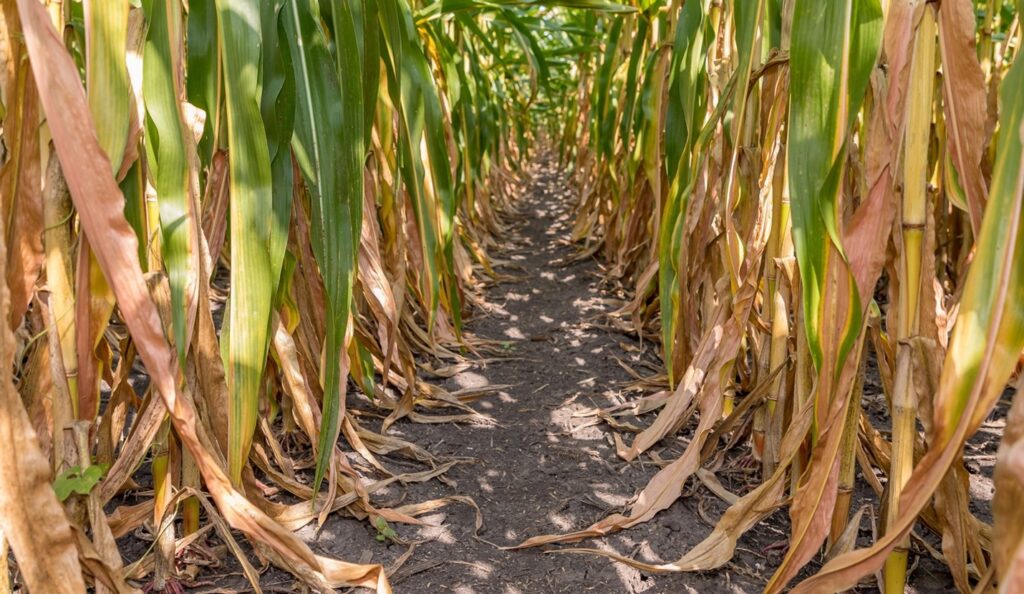
A few short weeks after this image was taken, the whole landscape would appear to look "green and protected" because the corn and soybeans will have emerged and leafed out, creating what appears to be a “canopy of protection.” However, we have to remember that because of the use of herbicides, ALL of these areas are kept completely void of any vegetation growing in and between the rows, other than the cash crop. In a typical cornfield, only approximately 6% of the surface of the soil ends up "covered" by the plant at the soil level, the rest is entirely void of vegetation between the corn (and soybean) plants.

No one can convince me that a significant portion of our water quality issues aren't due, in large part, to "how" we're farming the land. I believe these images say it all and provide compelling visual evidence to support that conclusion. Sadly, these are not "outlier" images. The photos represent most Midwestern farmland and much of the farmland in the continental U.S., as well as the whole surface of the agrarian earth itself.
It should not surprise us because we see it every day as we drive across the landscape, but we don't often grasp the dramatic extensiveness of it because our "perspective" isn't always from a "30,000-foot level," and because by mid-summer, the whole landscape APPEARS to be covered again in vegetation. Obviously, that is not the reality.
A better way is nature’s way
When the landscape-scale impact of tillage-intensive, conventional agricultural practices is considered, the resulting negative environmental consequences are not surprising.
However, thanks to God's gracious design (and assuming we follow the natural principles of soil health) the system is self-healing. It can even recover from the degraded condition illustrated in the satellite image above and do so remarkably quickly. Mostly, what our land needs is to simply be left alone, undisturbed, like those "wasteland areas" along the creeks and rivers in that photo.
I've found one of the most effective ways to positively impact the soil is to cover it completely with residue and living vegetation, and then allow animals to do the harvesting. As I’ve written about in my previous post, a grazing animal deposits nearly twice as much fertility as it removes while grazing, if it's "done right."
I like to quote a nursery rhyme in connection with this philosophy: "Leave 'em alone, and they'll come home, wagging their tails behind them." That's exactly what the biology of the soil, grazing animals and the environment will do, if we will just follow nature’s lead, Because, at its best, nature is intended to be God's "perpetual motion machine."

